Drone Solution
Drone Cinematography Solutions
Drone Media Solutions: Imagine wanting to show off your business from a whole new perspective—capturing breathtaking views from above that no ordinary camera can reach. But taking high-quality aerial shots isn’t as simple as flying a drone and pressing record. You need to plan the angles, control the movements, and capture the perfect lighting to truly make your brand stand out. Stunning aerial videos and photos can transform the way people see your business, giving them a unique experience of your story. That’s where StrateX comes in, delivering professional drone media solutions to elevate your brand's vision.
Drone 3D Mapping Solutions
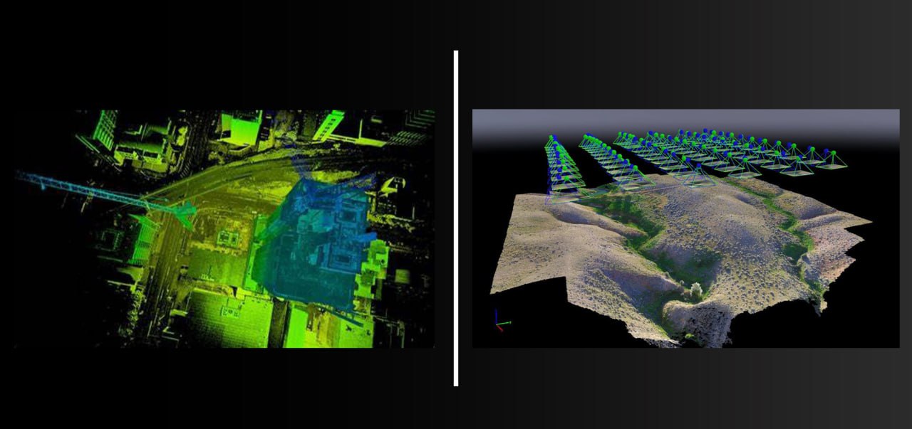
Drone 3D Mapping: Imagine you need to create a detailed, accurate model of a large area, like a piece of land, a construction site, or an entire neighborhood. With photogrammetry 3D mapping, this isn’t done by hand or from the ground; instead, it uses high-resolution aerial photos taken from a drone. The drone captures multiple overlapping images from different angles, and special software stitches these photos together, analyzing every tiny detail to build a fully textured, three-dimensional model of the area.
This 3D map lets you see the exact shape, size, and layout of everything on the land—perfect for planning, measurements, or even visualizing changes over time. Creating a photogrammetry 3D map requires expert knowledge in drone operation, image capturing, and mapping software to ensure precision. That’s where StrateX comes in, handling all the complex parts so you get a stunning, accurate 3D map tailored to your needs.